Big Creek Campground (great Smoky Mountains National Park)
National Park Service campground in Great Smoky Mountains National Park, near Gatlinburg, North Carolina.
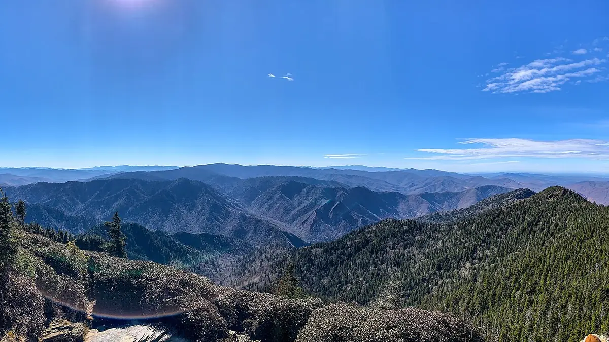
Summary
Big Creek Campground (great Smoky Mountains National Park) is a National Park Service campground in Great Smoky Mountains National Park, about 33 miles (straight line) from Asheville. The campground lists 12 overnight sites (including 12 tent-only sites); it charges a nightly fee of $30, and it is open seasonally (about May to Oct). Mountain bikers get 7.9 miles of bike-legal trail within 5 miles, the closest being Anst - Appalachian Rd (1.4 mi away). Sites are reservable on Recreation.gov; the largest accommodate RVs and trailers up to 18 ft.
When it's open
Seasonal (approx May–Oct) May 16 – Oct 24
- NPS lists a seasonal closure ("Closed") from Oct 25, 2026 to May 15, 2027.
North Carolina campgrounds open year-round →
Source: National Park Service, retrieved Oct 20, 2026. It says: “NPS operating hours: "Closed" Oct 25, 2026 – May 15, 2027” Opening and closing dates can shift with weather and staffing.
Hookups & amenities
- 🚿ShowersNot listed
- 🚻Toilets (flush)Listed
- 🚰Drinking waterListed
- ⚡Electric hookupsNot listed
- 💧Water hookupsNot listed
- 🔧Sewer hookupsNot listed
- 🔌Full hookups (E/W/S)Not listed
- 🚐Dump stationNot listed
- 📶Wi-FiNot listed
- 🧺LaundryNot listed
- 🏪Camp storeListed
- 🛝PlaygroundNot listed
- 🏊SwimmingNot listed
- 🚤Boat rampNot listed
- 🐕Pet-friendlyListed
- ♿ADA-accessible sitesNot listed
- 🛖CabinsNot listed
- 🔥Fire ringsListed
- 🍖GrillsListed
- 🪑Picnic tablesListed
- 🧑Camp hostListed
- 🐻Food storage lockersListed
Listed only when Recreation.gov site records report it. "Not listed" means the source doesn't say, not that the campground lacks it.
Map: trails and roads near Big Creek Campground (great Smoky Mountains National Park)
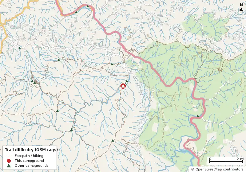
Loads MapLibre with OpenFreeMap tiles only when you tap.
Campsite layout
Check live availability on Recreation.gov ↗
We don't show live availability. Openings change by the minute and only the official reservation system has them.
How it compares
- With 12 sites it is the #44 largest of 83 North Carolina campgrounds that publish a site count.
- Its lowest fee ($30) is equal to the North Carolina median of $30/night.
- There are 50 other campgrounds in our data within 25 miles; 0 of them list a lower starting fee.
- 100% of North Carolina campgrounds that publish a length limit accept a rig this long (18 ft).
- 100% of sites with a shade rating are listed as shaded or partly shaded.
- Pets allowed on 12 of 12 sites; campfires allowed on 12 (subject to seasonal fire bans).
- Straight-line distance: Asheville ~33 mi, Knoxville ~48 mi, Abingdon ~92 mi.
Site mix
Amenities & rules
Camp hostDrinking waterFire pitsFire ringsFlush toiletsFood storage lockersGrillsLantern postsPicnic tablesQuiet areaTent padsWater spigotPets allowedTents
Nightly fee: $30, from the NPS Great Smoky Mountains fee rates page (retrieved Oct 20, 2026).
Fee notes from Recreation.gov: Individual Campsites: A customer who cancels a reservation the day before or on the day of arrival will pay a $10.00 service fee AND forfeit the first night's use fee (not to exceed the total paid for the original reservation). Cancellations for a one-night reservation will forfeit the entire amount paid and will not be subject to an additional service fee. Customers that check out early or do not…
Trails within 5 miles
| Trail | Closest point | Mapped miles within 5 mi | Source |
|---|---|---|---|
| Big Creek Trail | 0.1 mi | 6.1 | NPS |
| Big Creek Horse | 0.1 mi | 0.3 | NPS |
| Baxter Creek Trail | 0.1 mi | 6.1 | NPS |
| Chestnut Branch Trail | 0.6 mi | 2.0 | NPS |
| Appalachian Trail | 1.3 mi | 8.5 | NPS |
| Anst - Appalachian Rd | 1.4 mi | 7.9 | USFS |
| Lower Mount Cammerer Trail | 2.1 mi | 6.6 | NPS |
| Mount Cammerer Trail | 2.9 mi | 0.6 | NPS |
| Mount Sterling Trail | 3.2 mi | 2.2 | NPS |
| Low Gap Trail | 3.2 mi | 4.4 | NPS |
| Long Bunk Trail | 3.4 mi | 2.8 | NPS |
| Swallow Fork Trail | 3.6 mi | 3.7 | NPS |
+ 4 more named trails.
Mountain biking nearby
7.9 miles of bike-legal trail lie within 5 miles. Difficulty mix: Unrated: 7.9 mi
| Trail | Closest point | Miles within 5 mi | Difficulty (as tagged) | Kids | Source |
|---|---|---|---|---|---|
| Anst - Appalachian Rd | 1.4 mi | 7.9 | Unrated | USFS |
Ratings come only from OpenStreetMap mtb:scale / IMBA tags. Untagged trails show as "Unrated", and we never guess. Check conditions and maps on Trailforks or MTB Project.
Activities listed
Auto TouringBikingBoatingCampingFishingHikingHistoric & Cultural SiteHorse CampingHorseback RidingPicnickingVisitor CenterWater SportsWildlife Viewing
Nearest campgrounds
| Campground | Miles | State | Fee/night | Sites | Hookups | Max RV | Pets | Booking | Trails ≤5 mi |
|---|---|---|---|---|---|---|---|---|---|
| Big Creek Group Camp Great Smoky Mountains National Park |
0.2 | NC | $30 | — | — | — | yes | Reserve | 15 (53.2 mi) |
| Big Creek Horse Camp Great Smoky Mountains National Park |
0.4 | NC | $36 | 5 | — | 35 ft | yes | Reserve | 15 (51.7 mi) |
| Davenport Gap Shelter OpenStreetMap listing |
1.5 | TN | — | 12 | — | — | — | Reserve | 16 (48.8 mi) |
| Mount Sterling #38 National Park Service |
3.4 | NC | — | — | — | — | — | ? | 21 (65.2 mi) |
| Upper Walnut Bottom #36 National Park Service |
4.1 | NC | — | — | — | — | — | ? | 24 (82.5 mi) |
| Gilliland Creek #35 National Park Service |
4.2 | TN | — | — | — | — | — | ? | 20 (59.4 mi) |
Hookups: E = electric (max amps), W = water, S = sewer. "—" means the agency doesn't publish it. Trail counts are named USFS/NPS trails within 5 miles. 🟢 = kid-friendly (green-rated) bike trail nearby. "Open year-round" and month ranges come from the agency, state park or OpenStreetMap season; no tag means no season is published.