Cumberland Island National Seashore Camping Permits
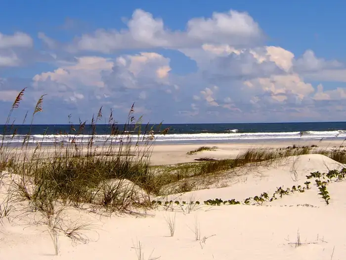
National Park Service campground in Cumberland Island National Seashore, near St. Marys, Georgia.
Summary
Managed by the National Park Service, Cumberland Island National Seashore Camping Permits sits in Georgia. The campground lists 44 overnight sites (including 2 group sites and 43 walk-in sites); it charges nightly fees from $9 to $22, and it is listed as open year-round. Camping is reservable on Recreation.gov. The listing reports showers, flush toilets, drinking water and food storage lockers.
When it's open
Year-round
More Georgia campgrounds open year-round →
Source: National Park Service, retrieved Oct 20, 2026.
Hookups & amenities
- 🚿ShowersListed
- 🚻Toilets (flush)Listed
- 🚰Drinking waterListed
- ⚡Electric hookupsNot listed
- 💧Water hookupsNot listed
- 🔧Sewer hookupsNot listed
- 🔌Full hookups (E/W/S)Not listed
- 🚐Dump stationNot listed
- 📶Wi-FiNot listed
- 🧺LaundryNot listed
- 🏪Camp storeNot listed
- 🛝PlaygroundNot listed
- 🏊SwimmingNot listed
- 🚤Boat rampNot listed
- 🐕Pet-friendlyNot listed
- ♿ADA-accessible sitesNot listed
- 🛖CabinsNot listed
- 🔥Fire ringsListed
- 🍖GrillsListed
- 🪑Picnic tablesListed
- 🧑Camp hostNot listed
- 🐻Food storage lockersListed
Listed only when Recreation.gov site records report it. "Not listed" means the source doesn't say, not that the campground lacks it.
Map: trails and roads near Cumberland Island National Seashore Camping Permits
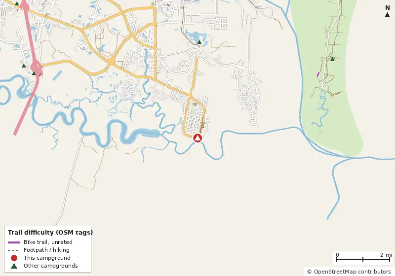
Loads MapLibre with OpenFreeMap tiles only when you tap.
Campsite layout
Check live availability on Recreation.gov ↗
We don't show live availability. Openings change by the minute and only the official reservation system has them.
How it compares
- With 44 sites it is the #49 largest of 92 Georgia campgrounds that publish a site count.
- Its lowest fee ($9) is $6 below the Georgia median of $15/night.
- There are 13 other campgrounds in our data within 25 miles; 0 of them list a lower starting fee.
- 88% of sites with a shade rating are listed as shaded or partly shaded.
- Straight-line distance: Atlanta ~267 mi, Charlotte ~314 mi, Asheville ~342 mi.
Site mix
Amenities & rules
Drinking waterFire ringsFlush toiletsFood storage lockersGrillsPicnic tablesShowersTents
Nightly fee: $9–$22, from the National Park Service (NPS Data API campground fees) page (retrieved Oct 20, 2026).
Fee notes from Recreation.gov: Nightly Camping Use Fees apply (see Facility Rates below)
Trails within 5 miles
| Trail | Closest point | Mapped miles within 5 mi | Source |
|---|---|---|---|
| Passenger Ferry | 0.0 mi | 7.2 | NPS |
| South Point Trail | 4.4 mi | 0.7 | NPS |
Mountain biking nearby
No bike-legal trails are mapped within 5 miles in OpenStreetMap or Forest Service data.
Ratings come only from OpenStreetMap mtb:scale / IMBA tags. Untagged trails show as "Unrated", and we never guess. Check conditions and maps on Trailforks or MTB Project.
Activities listed
BackpackingBeachcombingBikingBirdingBoatingCampingFishingHikingHuntingInterpretive ProgramsKayakingMotor BoatPhotographyRanger StationSailingSwimmingWater AccessWildlife Viewing
Nearest campgrounds
| Campground | Miles | State | Fee/night | Sites | Hookups | Max RV | Pets | Booking | Trails ≤5 mi |
|---|---|---|---|---|---|---|---|---|---|
| Eagle Hammock RV Park Private Private RV park |
3.6 | GA | — | — | E | yes | — | ? | 4 (9.0 mi) |
| Sea Camp Campground Private campground |
5.9 | GA | — | — | — | — | — | ? | 17 (17.3 mi) |
| KOA Holiday Private Cabins Private RV park |
6.6 | GA | — | — | E | yes | — | ? | 0 |
| Country Oaks Campground & Rv OpenStreetMap listing |
7.1 | GA | — | — | — | — | — | ? | 0 |
| A Big Wheel RV Park Private Private RV park |
8.1 | GA | — | — | E | yes | — | ? | 0 |
| Stafford OpenStreetMap listing |
8.3 | GA | — | 50 | — | — | — | Reserve | 25 (27.4 mi) |
Hookups: E = electric (max amps), W = water, S = sewer. "—" means the agency doesn't publish it. Trail counts are named USFS/NPS trails within 5 miles. 🟢 = kid-friendly (green-rated) bike trail nearby. "Open year-round" and month ranges come from the agency, state park or OpenStreetMap season; no tag means no season is published.