Fort Mountain State Park Campground Cabins
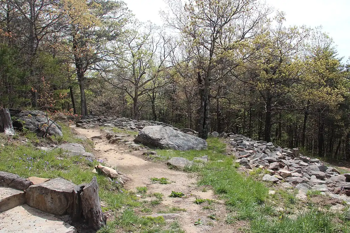
Georgia State Parks & Historic Sites (Georgia DNR) campground in Fort Mountain State Park, Georgia.
Summary
Fort Mountain State Park Campground is about 40 miles (straight line) from Chattanooga; it is run by Georgia State Parks & Historic Sites (Georgia DNR). It has 84 overnight sites and the state's published rate schedule ($23–$50). Within 5 miles there are 14.7 miles of trail open to bikes, the closest being Peeples Lake (1.6 mi away). Camping is booked through the state park reservation system.
When it's open
Season not listed
Georgia campgrounds open year-round →
Neither the state park system nor our other sources publish an open season for this campground, so we don't guess. Check the official listing before an off-season trip.
Hookups & amenities
- 🚿ShowersNot listed
- 🚻ToiletsNot listed
- 🚰Drinking waterNot listed
- ⚡Electric hookupsNot listed
- 💧Water hookupsNot listed
- 🔧Sewer hookupsNot listed
- 🔌Full hookups (E/W/S)Not listed
- 🚐Dump stationNot listed
- 📶Wi-FiNot listed
- 🧺LaundryNot listed
- 🏪Camp storeNot listed
- 🛝PlaygroundNot listed
- 🏊SwimmingNot listed
- 🚤Boat rampNot listed
- 🐕Pet-friendlyNot listed
- ♿ADA-accessible sitesNot listed
- 🛖CabinsListed
- 🔥Fire ringsNot listed
- 🍖GrillsNot listed
- 🪑Picnic tablesNot listed
- 🧑Camp hostNot listed
- 🐻Food storage lockersNot listed
Listed only when the state park system or OpenStreetMap report it. "Not listed" means the source doesn't say, not that the campground lacks it.
Cabins
Cottage/cabin (15). Source: Georgia State Parks park page. Check the booking site for availability, bedding and accessibility.
Map: trails and roads near Fort Mountain State Park Campground
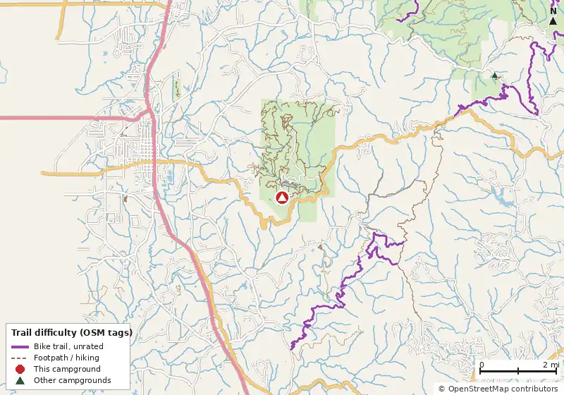
Loads MapLibre with OpenFreeMap tiles only when you tap.
Campsite layout
Check live availability (official reservation site) ↗
We don't show live availability. Openings change by the minute and only the official reservation system has them.
How it compares
- With 84 sites it is the #19 largest of 92 Georgia campgrounds that publish a site count.
- There are 17 other campgrounds in our data within 25 miles.
- Straight-line distance: Chattanooga ~40 mi, Atlanta ~72 mi, Knoxville ~95 mi.
Site mix
Amenities & rules
The agency hasn't published an amenity list for this campground.TentsRVs/trailers
Fee notes from the agency (source): Georgia State Parks publish one statewide schedule ("in most cases"): Regular campsite (most parks) $23–$50; Cottage/cabin $75–$250; Yurt $75–$100. Statewide published ranges ("in most cases"); not per-park rates. A daily ParkPass (parking) is extra and paid once per vehicle per stay. Seniors get 20% off campsites (one site, not group camping).
Trails within 5 miles
| Trail | Closest point | Mapped miles within 5 mi | Source |
|---|---|---|---|
| Peeples Lake | 1.6 mi | 0.3 | USFS |
| Pinhoti | 2.0 mi | 13.4 | USFS |
| Rock Creek Atv | 2.4 mi | 4.3 | USFS |
| Tatum Lead Ohv Trail | 3.1 mi | 4.7 | USFS |
Mountain biking nearby
14.7 miles of bike-legal trail lie within 5 miles. Difficulty mix: Unrated: 14.7 mi
| Trail | Closest point | Miles within 5 mi | Difficulty (as tagged) | Kids | Source |
|---|---|---|---|---|---|
| Peeples Lake | 1.6 mi | 0.3 | Unrated | USFS | |
| Pinhoti Trail | 2.5 mi | 6.1 | Unrated | OSM | |
| Rock Creek | 2.6 mi | 3.6 | Unrated | OSM | |
| Tatum Lead Ohv Trail | 3.1 mi | 4.7 | Unrated | USFS |
Ratings come only from OpenStreetMap mtb:scale / IMBA tags. Untagged trails show as "Unrated", and we never guess. Check conditions and maps on Trailforks or MTB Project.
Dump stations near Fort Mountain State Park Campground
| Public dump station (OpenStreetMap) | Distance | Fee | Water | Access |
|---|---|---|---|---|
| Dump station (unnamed in OSM) | 15.6 mi | Not listed | Not listed | Not listed |
Nearby campgrounds with an on-site dump station: Woodring Campground (10.1 mi), Doll Mountain Campground (10.8 mi). Many limit dumping to registered guests.
Straight-line distances. Dump station points: © OpenStreetMap contributors (ODbL); fees, hours and access change, so confirm before you go.
Nearest campgrounds
| Campground | Miles | State | Fee/night | Sites | Hookups | Max RV | Pets | Booking | Trails ≤5 mi |
|---|---|---|---|---|---|---|---|---|---|
| Mulberry Gap mountain bike getaway OpenStreetMap listing |
6.5 | GA | — | — | — | — | — | ? | 15 (54.3 mi) |
| Lake Conasauga Overflow Campground Chattahoochee-Oconee National Forest |
7.7 | GA | $8 | 6 | — | 25 ft | yes | First-come | 18 (54.5 mi) |
| Lake Conasauga Campground Chattahoochee-Oconee National Forest |
8.2 | GA | $15 | 29 | W | 25 ft | yes | Reserve | 20 (63.0 mi) |
| Ball Field Group Camping Area OpenStreetMap listing |
8.6 | GA | — | — | — | — | — | ? | 21 (76.1 mi) |
| Bear Creek Campground Open year-round United States Forest Service |
9.5 | GA | Free | — | — | — | — | ? | 10 (48.9 mi) |
| Woodring Branch Primitive Campground Open year-round Carters Lake |
9.7 | GA | $10 | 11 | — | — | yes | Reserve | 0 |
Hookups: E = electric (max amps), W = water, S = sewer. "—" means the agency doesn't publish it. Trail counts are named USFS/NPS trails within 5 miles. 🟢 = kid-friendly (green-rated) bike trail nearby. "Open year-round" and month ranges come from the agency, state park or OpenStreetMap season; no tag means no season is published.